
Dr. Pathak has done his Masters in Environmental Sciences from Savitribai Phule Pune University and completed his doctoral work from University of North Carolina at Greensboro, NC, USA. He has work experience with both industry and academia.
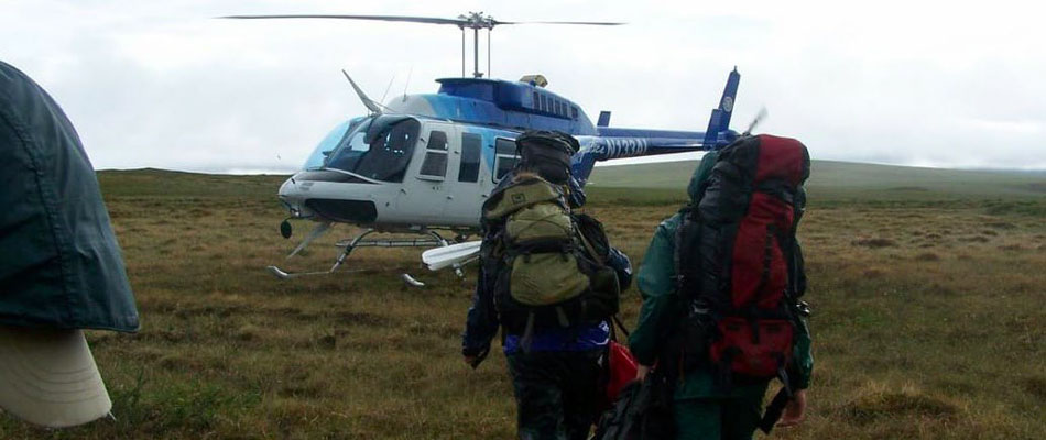
Prasad’s doctoral work is about understanding empirical relationships between lakes and landscape parameters in Arctic Alaska. Arctic Alaska is one of the most highly sensitive regions in the world for climate change. Even though nobody resides there, the sensitive ecosystems are impacted by rising temperatures more than other regions. Lakes in this region appear only during summer, otherwise they are frozen. During summer, the lakes would be ecologically active. They are, however, not supposed to be nutrient-rich (oligotrophic). With climate change, the permanently frozen soil around them is warming up and hence, the vegetation there is changing. This may deliver more nutrients to those lakes. It is required to keep detailed notes of the current situation about the lakes and their nutrient status with respect to their surroundings. To map the current status, Prasad used satellite data along with field work for 37 lakes and their respective watersheds. This research was supported by National Science Foundation, USA.
Back in India, Prasad has been working on urbanization-related studies. India being one of the rapidly urbanizing countries while ostensibly developing 100 smart cities, Prasad focuses on using GIS and remote sensing for Urban Heat Island (UHI) development (urban sensing using low-cost sensors and walkability issues in urban areas). UHI is experienced by urbanized areas’ higher temperatures in comparison with its rural counterparts. The increased temperatures are due to man-made surfaces such as concrete and asphalt which occur in cities with high density. These surfaces retain the heat energy received from the Sun and release it over time which, in turn, results into UHI. UHI effect is tightly linked with city energy demand as cities have to spend more energy to keep indoor environment comfortable using air conditioning. The use of air conditioning feeds into the vicious cycle by increasing the outdoor temperatures. Thus, the combination of UHI and energy demand feed into climate change at its own level. UHI also affects the health of urban dwellers, especially, the communities which don’t have access to resources as they cannot adapt to the rising temperatures in the cities. Natural resources like trees and water bodies are also negatively affected due to UHI effect. Thus, it is critical to study the nature of UHI effect and to seek solutions while urbanization continues. The traditional way to study UHI is to use satellite images. Satellite sensors, e.g. Landsat, have the ability to detect the temperature of the Earth’s surface. These satellite images help understand the nature, extent and seasonality of UHI over urbanized areas, globally.
Recently, Prasad and his international collaborators observed that scientific studies using Landsat images to explore UHI have limitations and that other datasets may in fact be better. Prasad, along with a research group from McGill University, has suggested that one needs to look at urban areas within different climate zones differently and also understand how “rural” and “urban” are defined as that will make a difference in the very definition of UHI existence. For example, areas where a rural background is forest would create different temperature gradient between its urban counterparts as compared to agricultural areas around cities. Besides that, UHI should be technically studied at night-time and hence, the satellite sensors capturing night-time images would be more helpful in studying UHI effect. The research team demonstrated that using night-time images captured by MODIS satellites provide more accurate UHI measures than day-time images. A research paper describing these findings has been submitted to a very prominent journal.
Another limitation of using only satellite data to study UHI is that it does not reveal details at the local (neighborhood) level in a city. Because of UHI, the surfaces like roads, building facades, etc. would be heated. They also impact air temperature around them. The composition of neighborhood—if the buildings are densely packed or they have enough distance between them, how many roads are running through the area and other build environment parameters—would impact how intense the UHI effect is in each area. To study the surface and air temperature together, theoretically, one would need weather stations everywhere. It is not a feasible method to collect data by such means. The research group has designed low-cost sensors using Arduino Uno boards to capture these variations. The units cost less than ₹5000. The data from these units will not only supplement satellite images but will enable us to perform detailed local analysis of UHI. This concept was supported (funded) by ICIMPACTS, Canada. This research has supported several research scholars leading to their PhD and Masters dissertations in India and Canada.
Another focus area for Prasad is walkability issues in urban areas. Urban dwellers are leading sedentary lifestyles, in general. At the same time availability of vehicles and urban planning around automated transportation has led to reduced walking. This is tightly linked with the wellbeing of people and air pollution levels. Some preliminary work carried out by Prasad along with scholars from Duke Global Health Institute, Duke University, NC, USA evaluates walkability infrastructure in Greater Noida. It was observed that the city, being a planned city, has segregated residential sectors and industrial and institutional sectors. This compelled users to use vehicles. Even a walk for exercise was difficult according to the citizens. The results of our survey, however, showed that walkways were available in many parts of the city. The vehicle-pedestrian conflict could be the deterring factor for people not opting to walk. They demonstrated that city walkability for Indian cities can be effectively analyzed using Geographic Information Systems (GIS). Variations of different parameters such as availability of crossings, pedestrian paths, etc. were analyzed individually and cumulatively at the same time using GIS.
Professor Prasad Pathak, at Arctic Circle, in Alaska
In India, funding agencies such as Department of Science and Technology, Ministry of Environment, Forestry and Climate Change and Ministry of Urban Development and Housing support these kinds of studies. In addition, there are international agencies which are eager to collaborate with Indian scholars to explore urban growth in India.